این بخش هنوز ترجمه نشده است و به همین دلیل به انگلیسی نمایش داده میشود.
تاریخچه
Ahlat, on the north-western shore of Lake Van, came under Muslim rule in 640-6411. From the early 12th century it was the capital of the Ahlatshahs, and TDV says it then became one of the largest cities of the Islamic world1. It passed to the Ayyubids in 1207-1208, and in April 1230 the Khwarazmshah Jalal al-Din took it after an eight-month siege; TDV says the city was then plundered for three days despite his opposition1. After the Mongol invasions of the 1230s and 1240s it slowly lost its importance1. The Akkoyunlu emir Bayındır took it in 1472 after a six-month siege1,4. In the 16th century Safavid attacks razed the old citadel, and the Ottomans built a new fortress on the lake shore, where modern Ahlat grew1.
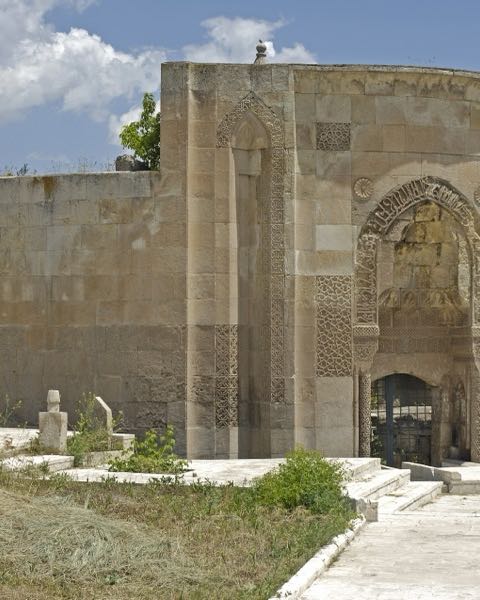
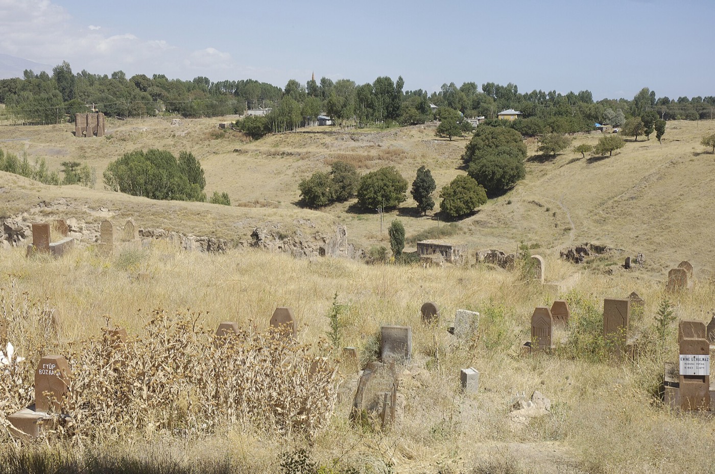
The tomb monuments of the 12th to 15th centuries stand mostly around the Meydan cemetery and in the old quarters, and TDV calls them an open-air museum of medieval Turkish tomb types: kümbets, vaulted burial chambers known locally as akıt, and gravestones2. About a thousand graves have head- and footstones, which reach up to 3.50 m and are carved on every face2. Of the gravestones whose inscriptions have been read, TDV counts 4 from the Ahlatshah period, 8 Ayyubid, 54 Mongol, 4 of the Bitlis rulers and 4 Safavid1. Since 2000 the tombstones have been on Türkiye's UNESCO Tentative List7. Many of them also carry the names of the masters who carved them5,7.
معماری
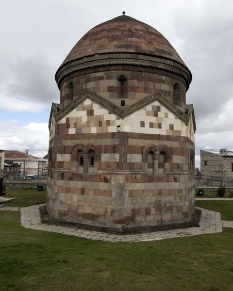
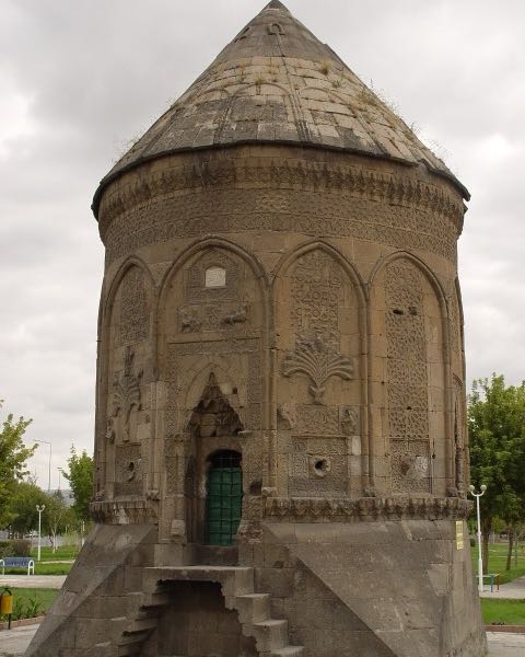
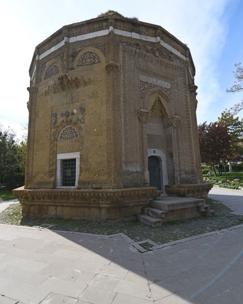
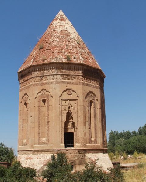
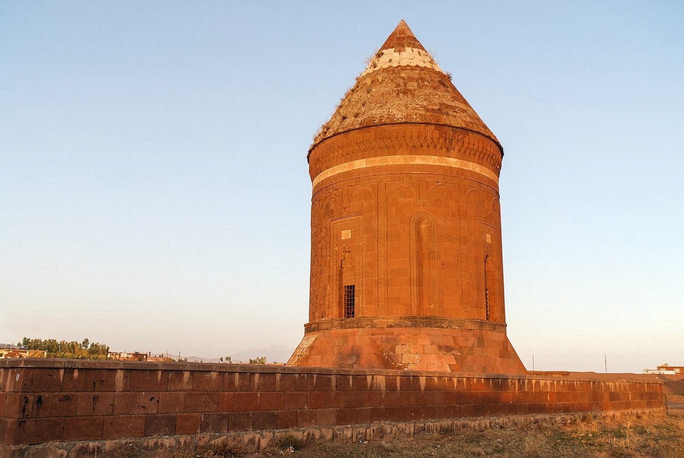
Ahlat's kümbets follow one scheme: a burial crypt below, and above it a room with a dome inside and a conical or pyramidal cap outside; those of the 13th century have cylindrical bodies and those of the 14th century polygonal ones2. The upper room was planned as a small prayer room with the qibla marked, and its door, usually on the north, sits high above the ground, so stairs were added in modern restorations2. The kümbets are built of volcanic cut stone, with inscriptions mostly on white stone2. The Ulu Kümbet (“great kümbet”, also called Usta Şagirt, “master and apprentice”), south of the Meydan cemetery near the lake, is the largest; it has no inscription, and TDV dates it to the last quarter of the 13th century while Faruk Sümer argued for about 13402,3,4.
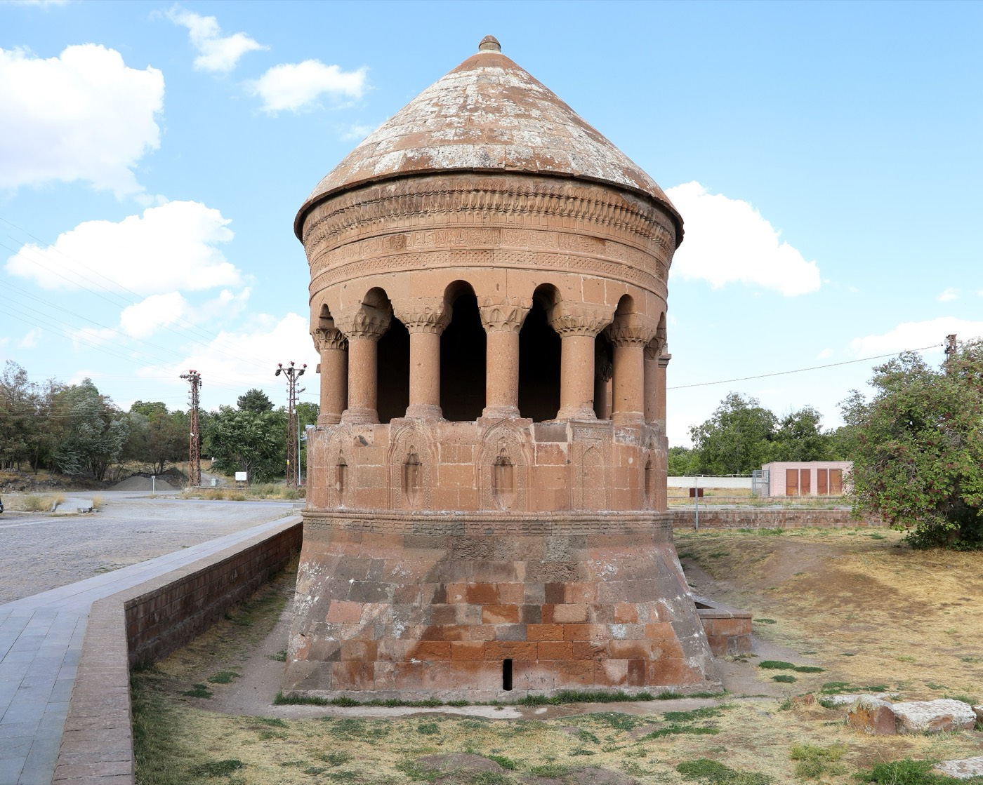
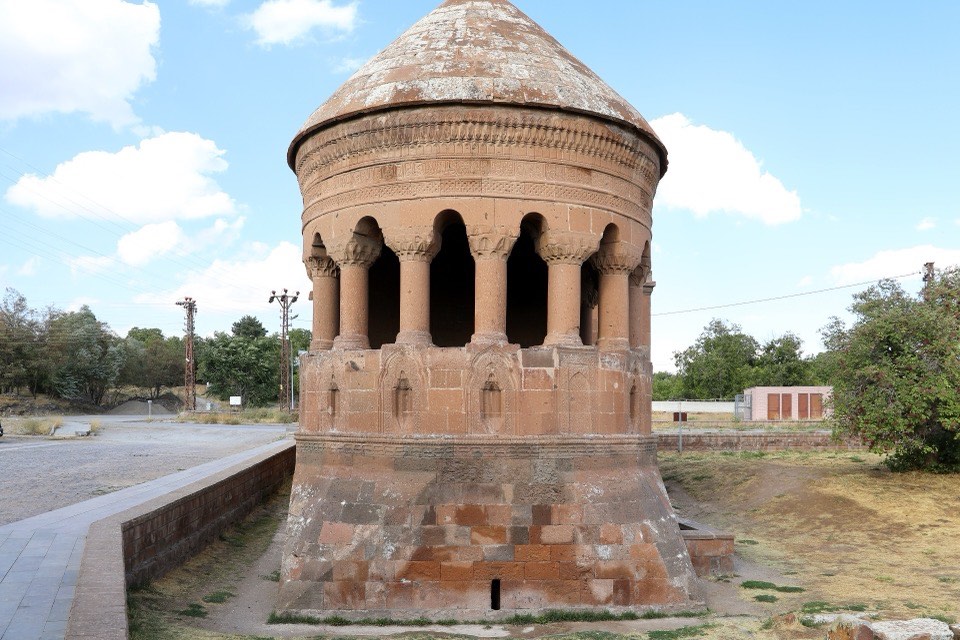
On a hill opposite stands the Hasan Padişah Kümbeti, built in January 1275 for Mahmud son of Hüsameddin Hasan Aka; TDV says the “Hasan Padişah” of local memory was the Mongol governor of Ahlat, not the Akkoyunlu ruler Uzun Hasan, and that a restoration begun in 1969 renewed all of it except the crypt and the north-facing quarter of the body2,6. In the İki Kubbe quarter two dated kümbets stand side by side, those of Hüseyin Timur and Esentekin Hatun (1279-1280) and of Emir Bugatay Aka and Şirin Hatun (1281)2. The Emir Bayındır Kümbeti stands about 2 m south of the Bayındır mosque, whose inscription is dated 1477-1478 and which carries the signature of the architect Baba Can on a white stone5,9. TDV says that Bayındır's wife Şah Selime Hatun had the kümbet built after the Akkoyunlu emir Bayındır son of Rüstem died in November 1481, that its architect is thought to be Baba Can too, and that an inscription running around its upper part gives his titles and tells of his life2,3,9. TDV calls its form unique in Anatolia: on the south side, facing the lake and the qibla, the cylindrical body opens into a gallery of arches on squat columns, eight in TDV's count and ten in Yelen and Sarı's2,5,9.
درون بنا
Visitors walk among the head- and footstones of the Meydan cemetery, many of them carved with inscriptions and ornament on every face2. In the kümbets, steps lead down to vaulted crypts whose doors usually face east and whose slit windows have carved frames, while restored stairs climb to the upper prayer rooms2. The crypt of the Hasan Padişah Kümbeti, lit by three slit windows, holds three graves under a cross vault; Evliya Çelebi, who entered it in 1655, saw dried bodies there, which were destroyed in a fire in 19106. The half-open upper room of the Emir Bayındır Kümbeti has a carved mihrab niche5,9.
آنچه باید دید
- The open gallery of squat columns on the Emir Bayındır Kümbeti, a form TDV calls unique in Anatolia2.
- Head- and footstones up to 3.50 m tall, carved on every face2.
- The Ulu Kümbet near the lake, the largest kümbet in Ahlat3.
- The twin kümbets of İki Kubbe, with inscriptions of 1279-1280 and 12812.
- The Hasan Padişah Kümbeti on its hill, dated by its inscription to January 12756.
بازدید
- The Ulu Kümbet stands south of the Meydan cemetery close to Lake Van3. TDV places the Emir Bayındır Kümbeti and its mosque in the İki Kubbe quarter9.
- UNESCO's tentative-list text speaks of six cemeteries in Ahlat; Bitlis's culture directorate counts five historic cemeteries of the Seljuk period and one of the Ottoman period, puts the Seljuk cemetery at about 200 dönüm (some 20 ha) and counts 14 kümbets in the district7,8.
- The site has been on Türkiye's UNESCO Tentative List since 25 February 2000 as “The Tombstones of Ahlat the Urartian and Ottoman citadel”7.
اطلاعات رسمی: Republic of Türkiye Ministry of Culture and Tourism, through the Bitlis Provincial Directorate of Culture and Tourismمسیریابیباز کردن در OpenStreetMapتورهای همراه با راهنما در اخلاط