این بخش هنوز ترجمه نشده است و به همین دلیل به انگلیسی نمایش داده میشود.
تاریخچه
Sher Shah, born Farid Khan, was the son of Hasan, a jagirdar (holder of a land grant) at Sasaram in Bihar1. Starting from that small estate, he drove the Mughal emperor Humayun from his throne, took Delhi in 1540 and founded the Sur dynasty of Afghan rulers1,5. He reigned for only five years and died during his siege of the fort of Kalinjar in May 15451,5. Archnet notes that some historians take the tomb’s location at Sasaram as a sign that it was begun before he took Agra and Delhi in 15403. Archnet names the architect as Alawal Khan, whom Kuraishi identifies as superintendent of buildings under both Sher Shah and his son2,3.
Inscriptions around the mihrab record that his son Islam Shah completed the tomb on 7 Jumada II 952 AH (16 August 1545), about three months after Sher Shah’s death1,2. The original arched bridge to the north shore was already in ruins when William Hodges saw it in 1780-17832. In 1882 the government repaired the tomb, built a causeway to the north shore and replaced the small cupola on the dome with a pinnacle like that of Hasan Khan’s tomb, a change Theodor Bloch of the ASI criticised in 19022,6. In 2007 the culture minister told Parliament that the ASI had gone to the Patna High Court to have illegal constructions removed from the protected site8.
معماری
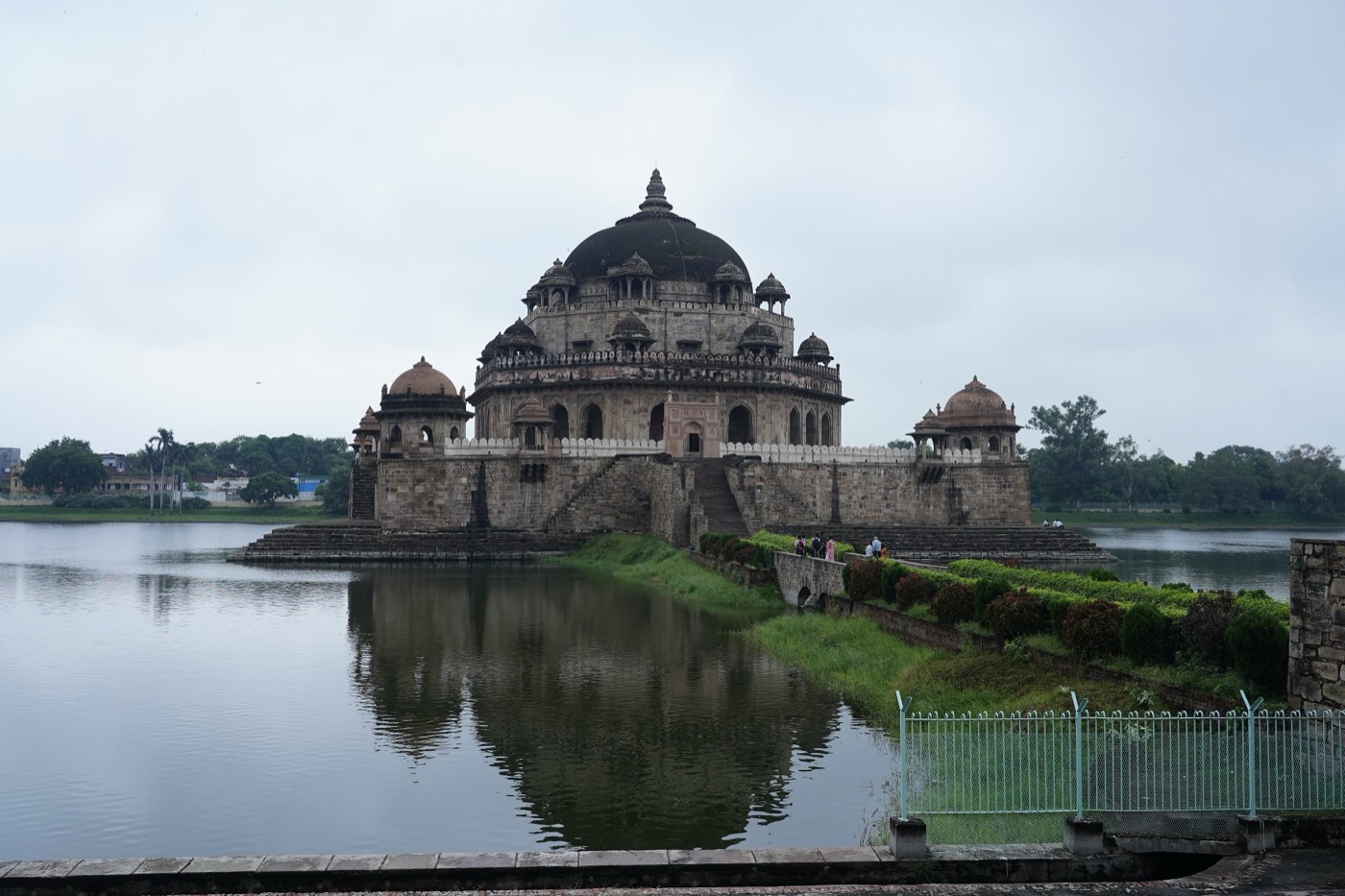
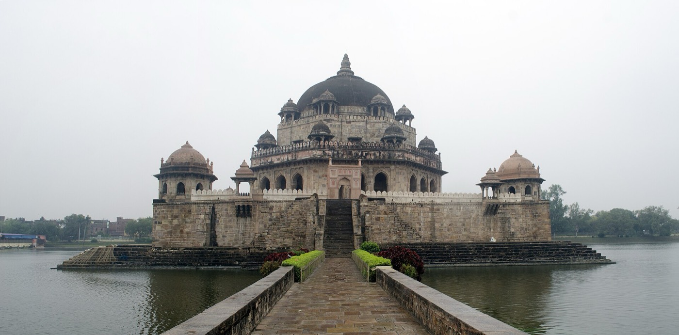
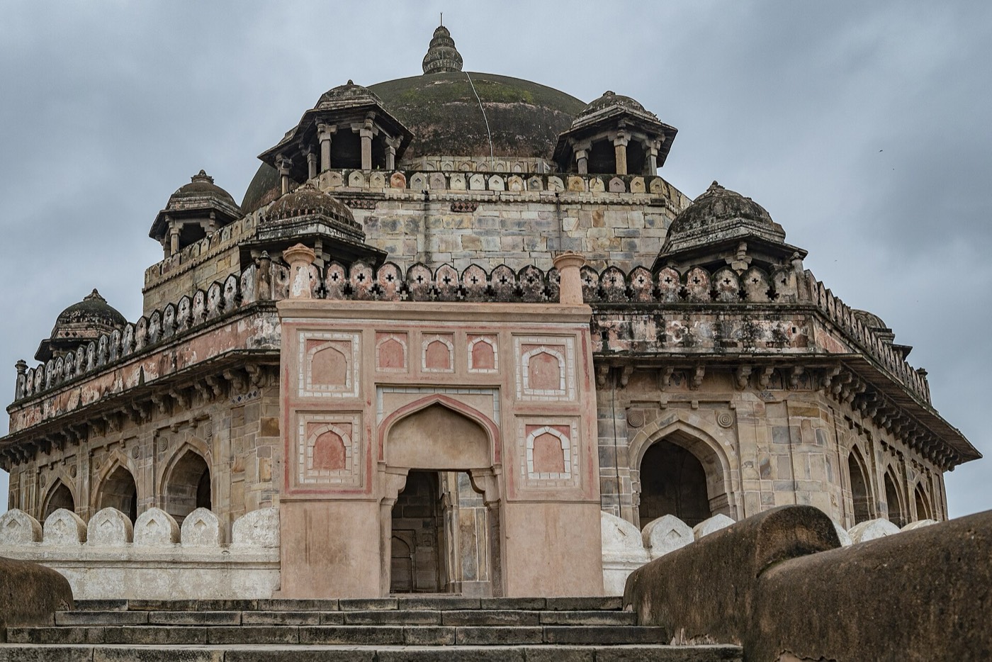
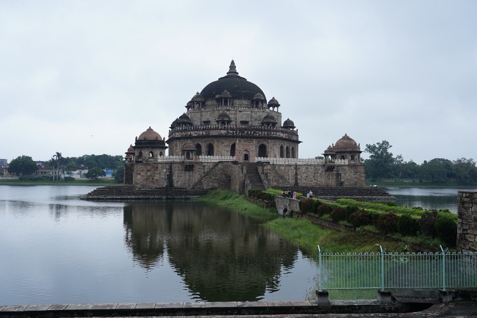
The tomb rises from a stone platform 243 ft (74 m) square in the middle of an artificial lake, with steps on all four sides leading down to the water2,3. On it stands a high terrace enclosed by a battlemented parapet, with an octagonal domed pavilion at each corner1,2. Because the platform is not aligned with the cardinal points, the terrace was set at an angle on it so that the tomb’s west wall, which holds the mihrab, faces Mecca2,3. The ASI calls the tomb one of the noblest specimens of Afghan architecture in India1. Archnet places its island setting in the jal mahal (“water palace”) tradition used by both Hindu and Muslim builders in the northern subcontinent3.
The tomb is an octagon in three stages: an arcaded verandah with three pointed arches on each side, a set-back upper stage with domed kiosks (chhatris) at the corners, and a sixteen-sided drum carrying the dome2,3. According to the ASI it rises 37.57 m above the terrace1. Archnet describes the structure as sandstone, while the ASI calls it a brick structure partly veneered with stone1,3. Kuraishi recorded a band of glazed tiles in dark blue, light blue, yellow and white below the verandah’s eaves, which rest on heavy brackets2. In 1928 John Marshall contrasted the largely Persian spirit of Rukn-i-Alam’s tomb at Multan with Sher Shah’s, which in his view had gone far towards becoming Indian7.
درون بنا
The burial hall is an octagon 71 ft 6 in (about 22 m) across with walls 16 ft (about 5 m) thick, and Archnet gives its height as about 31 m2,3. About 26 ft (8 m) above the floor the walls turn into sixteen sides, each pierced by a window with a stone jali in one of eight patterns, and higher up into thirty-two sides with small arched recesses below the dome2. Kuraishi quotes Alexander Cunningham’s view that this was the largest dome in northern India2. Sher Shah’s grave lies on a low plinth in the centre, with 24 other graves at its feet2. The mihrab in the west wall is carved with Quranic verses and inscriptions and keeps traces of glazed tile and carved floral stonework2,3.
آنچه باید دید
- The walk along the causeway from the domed gatehouse on the north shore to the island2,3.
- The terrace turned at an angle on its platform so that the mihrab faces Mecca2,3.
- Stone jali windows in eight different patterns high in the burial hall2.
- Traces of glazed tile and carved stone on the mihrab, with the 1545 completion inscription1,2,3.
- The octagonal domed pavilions at the four corners of the terrace1,2.
بازدید
- The tomb stands in a lake on the west side of Sasaram, a town on the Grand Trunk Road about 160 km south-west of Patna1,2.
- The island is reached along a stone causeway from a domed gatehouse on the north shore2,3.
- Sasaram also has the tomb of Sher Shah’s father, Hasan Khan Sur, and the unfinished tomb of his son Islam Shah1,4,6.
اطلاعات رسمی: Archaeological Survey of India (ASI), Patna Circleمسیریابیباز کردن در OpenStreetMapتورهای همراه با راهنما در ساسارام