Esta parte aún no se ha traducido, por lo que se muestra en inglés.
Historia
Ahmad Sanjar governed Khorasan for the Seljuks from about 1096 and was sultan from 1118 until his death on 8 May 11577,8. Under him Merv, his capital, reached what Britannica calls the zenith of its glory, and he walled the suburbs north and south of the medieval city now called Sultan Kala2,3,8. In 1153 the Oghuz tribes captured him and held him for about two years; he escaped but died without restoring order in Khorasan7. His mausoleum was built at the centre of the Seljuk city, not as a free-standing tomb but as part of a large religious complex that included the city’s main mosque, whose courtyard outline can still be traced from the air1,3.
The builder was Muhammad ibn Atsiz of Sarakhs, whose inscription in the dome had been plastered over and was found only in the 1950s3,4. Merv was sacked by the Mongols in 12213. When the Russian scholar V. A. Zhukovsky photographed the mausoleum in 1896, its outer dome had fallen and its galleries were badly damaged; it was the only building standing in the area3. The architect N. M. Bachinskii made the first structural survey during repairs in 1937, and excavation east of the tomb has exposed the foundations of the adjoining mosque3. UNESCO inscribed Ancient Merv on the World Heritage List in 1999, and Türkiye’s aid agency TİKA restored the mausoleum between 2001 and 20041,4.
Arquitectura
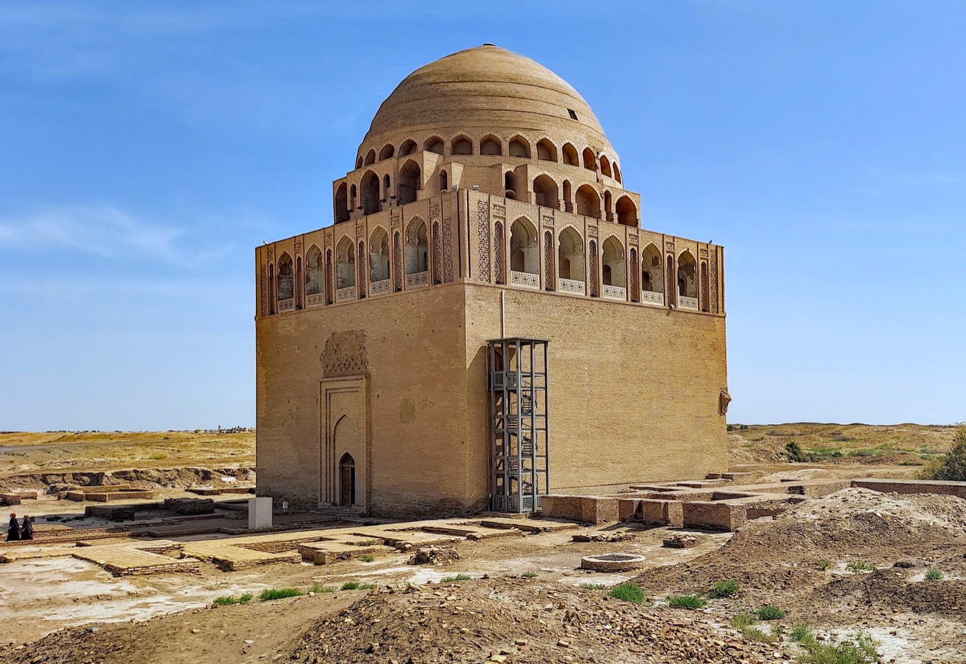
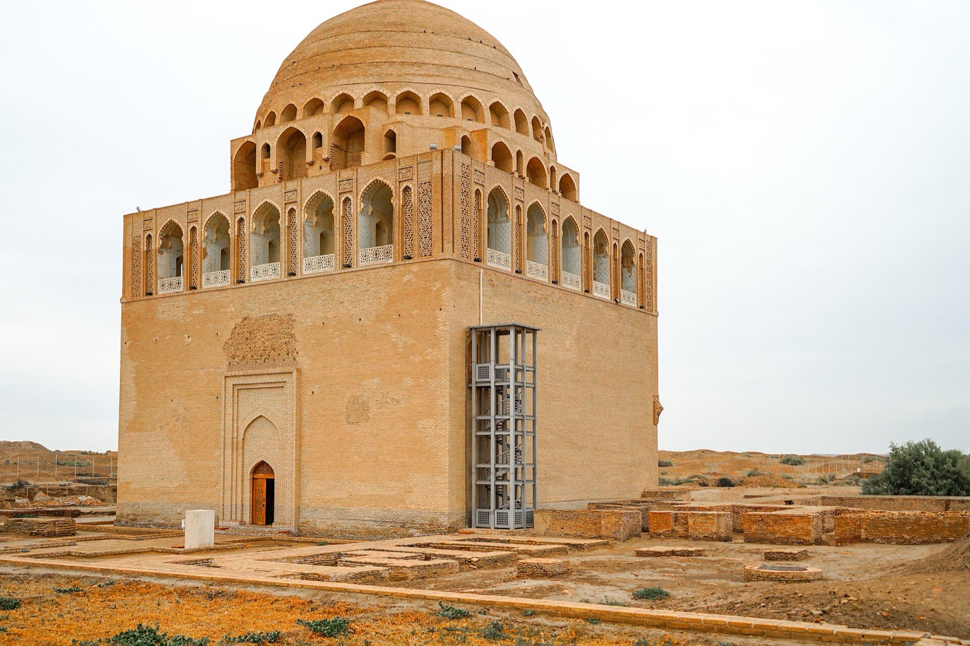
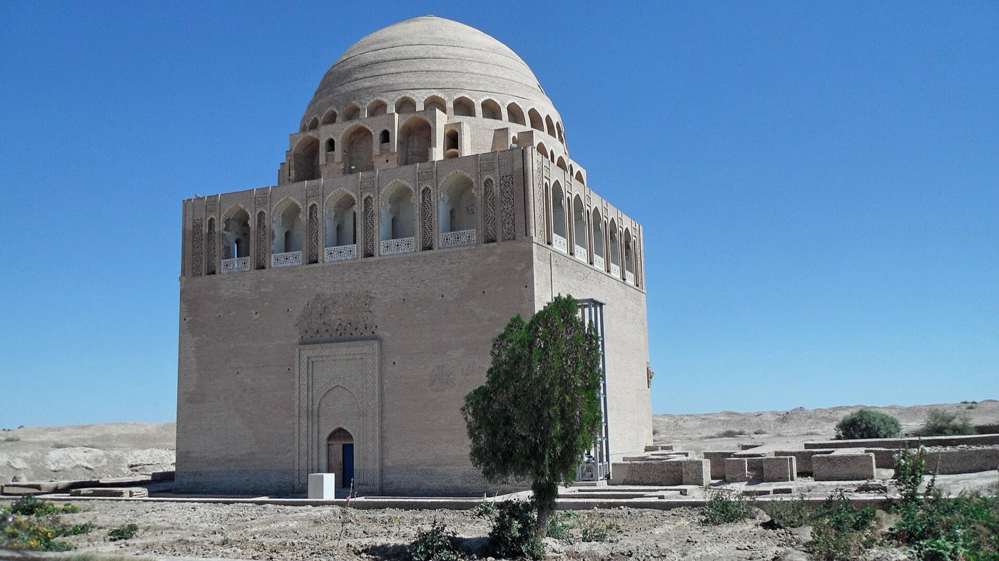
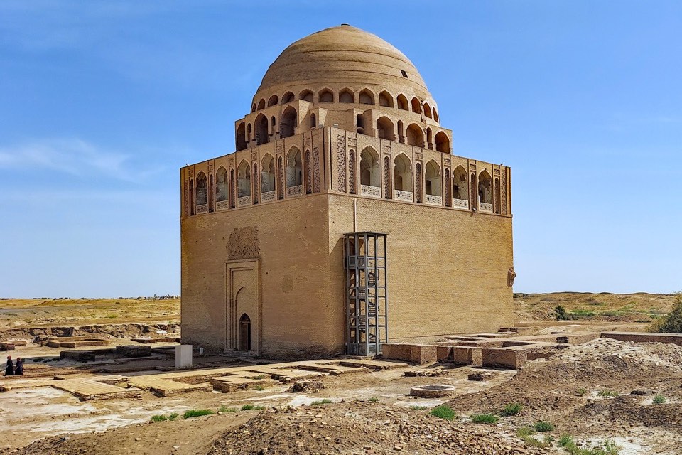
The mausoleum is a square, cube-like block of fired brick; Encyclopaedia Iranica calls it the largest Seljuk domed chamber3,5. Inside, four large squinches alternating with blind arches turn the square into an octagon, and muqarnas pendentives carry the round base of the dome3. From these pendentives ribs rise and interlace across the dome into an eight-pointed star, with three-lobed panels between them and a small oculus at the top3. Outside, an arcaded gallery runs round the base of the dome, with engaged brick columns and geometric panels between the arches and carved stucco on their soffits; stucco grilles once filled the arches3.
The dome was double, and its outer shell, covered with turquoise tiles, could be seen from far off; it had collapsed before the first photographs were taken3. O’Kane suggests that the stucco of the main arcade is the work of craftsmen who had earlier worked at Ribat-i Sharaf5. UNESCO singles out the brickwork, the carved stucco and the surviving wall paintings, and counts the building among the outstanding architectural achievements of the Seljuk period1. Encyclopaedia Iranica places it in the Iranian line of princely tombs that runs from the Samanid mausoleum in Bukhara to Öljeitü’s at Soltaniyeh and Timur’s in Samarkand6.
Interior
Visitors enter the square hall through doorways on the east and west; the west arch has been heavily restored, and there may once have been only one entrance3. The squinches and lower walls are plain, in contrast with the ribbed dome and its eight-pointed star3,5. Traces of the original painting survive: blue and red arabesques on a white ground along the ribs and arches, and panels of inscriptions and floral motifs at the top of the walls3. The cenotaph in the middle of the floor dates only from the early 20th century3.
Qué observar
- The dome’s ribs, interlacing into an eight-pointed star around a small oculus3.
- Remains of blue and red painted arabesques on the ribs and arches3.
- The arcaded gallery round the base of the dome, with carved stucco on its soffits3,5.
- The excavated foundations of the mosque complex that once surrounded the tomb3.
- The walls of Sultan Kala, built between the 11th and 13th centuries, within the same World Heritage property1.
Visita
- The mausoleum stands at the centre of Sultan Kala, the walled Seljuk city inside the Ancient Merv park in Mary province1,3.
- The park’s headquarters is close to the mausoleum2.
- Nearby stands the mausoleum of Muhammad ibn Zayd (1112), whose domed chamber has a Kufic inscription1,2.
Información oficial: State Historical and Cultural Park “Ancient Merv”, an office of Turkmenistan’s Ministry of Culture (as described by UNESCO and ICOMOS)Cómo llegarAbrir en OpenStreetMapVisitas guiadas en Merv