Questa parte non è ancora stata tradotta, perciò è mostrata in inglese.
Storia
The Chaukhandi graveyard lies about 27 km from Karachi on the road to Thatta, spread along a high ridge for about 1.5 km3. Pakistan's Department of Archaeology and Museums (DOAM) and Sindh's antiquities directorate describe its pyramidal tombs as those of Baloch warrior families who settled in the area in the 17th and 18th centuries2,3. Other sources disagree: Archnet names the Baluchi and Burfat tribes and spreads the tombs over the 15th to 19th centuries, while the researcher Zulfiqar Ali Kalhoro calls Chaukhandi the village near Karachi where dignitaries of the Jokhia (Jokhio) tribe are buried5,6. Tombs of the same type are found in southern Balochistan, at Lasbela, and in Thatta district3.
Architecture scholars at the University of Engineering and Technology in Lahore note that this chaukhandi type is specific to Sindh and Balochistan, and that such tombs are known locally as gharriyoon ('the chiselled ones'), pathar-jun-qabroon or rumis4. They observe that, despite Islamic reluctance about images, figures are the main theme in the ornament of Sindhi tombs from the 14th to the early 19th century, and that the chaukhandi tombs are the most notable examples4. Pakistan placed the Chaukhandi graveyard on its tentative list for World Heritage on 14 December 19931. The site is federal property, protected under the Antiquities Act of 19752.
Architettura
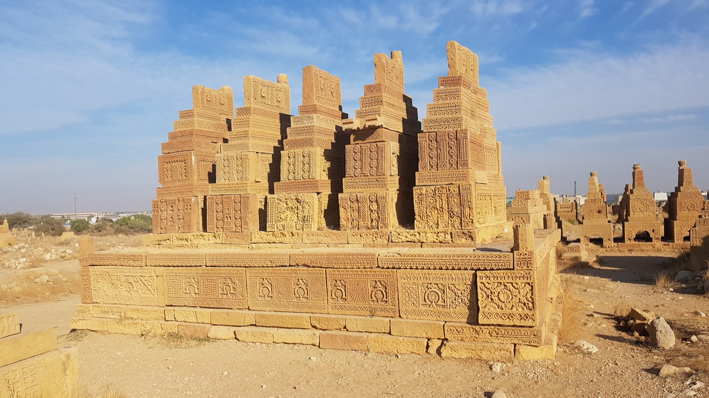
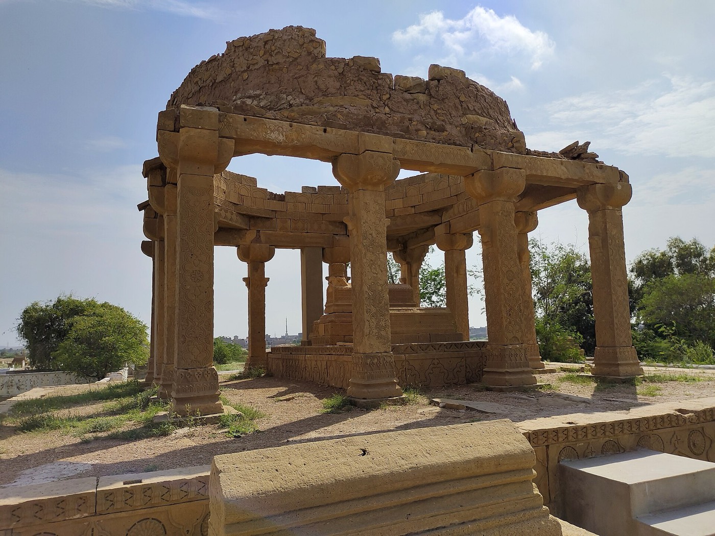
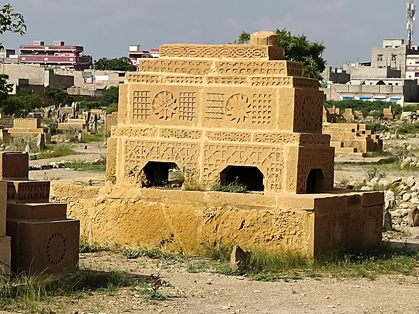
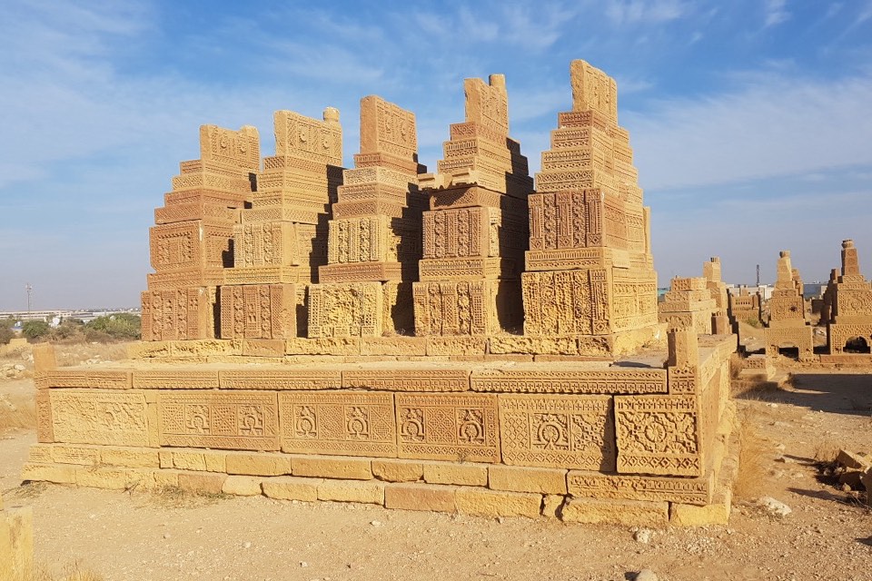
Each grave is built of carved sandstone slabs stacked in stepped tiers, which gives it its pyramidal shape; Akhtar and her co-authors write that the number of tiers reflected the social, political and economic standing of the dead2,4. Most graves stand on raised platforms, and each platform with its group of graves was a family burial ground1,3. A platform may carry a single grave or many3. Only a few groups stand under pillared canopies, which UNESCO's tentative-list entry describes as finished in Hindu style1,3.
The slabs are carved in relief with human and other figural designs as well as conventional patterns1,2. Men's graves show a horseman with his weapons, a shield, sword, bow and arrow, and some have a boss at the northern end of the top slab, carved to represent or hold the turban of the dead man1,2,3. Women's graves are marked by jewellery: necklaces, bracelets, anklets and rings1,2,3.
Cosa osservare
- Stepped graves of carved sandstone slabs rising in tiers on family platforms3,4.
- Horsemen with shield, sword, bow and arrow carved on men's graves2.
- Necklaces, bracelets, anklets and rings carved on women's graves2.
- Turban bosses at the northern end of the top slabs of men's graves1,3.
- The few groups of graves under pillared canopies in Hindu style1,3.
Visita
- The graveyard lies about 27 km from Karachi, on the road to Thatta3.
- Makli Hill near Thatta, further along the same road, has older graves of the same stepped type from the Samma period3,4.
Informazioni ufficiali: Directorate General of Antiquities and Archaeology, Culture, Tourism, Antiquities and Archives Department, Government of Sindh; the DOAM lists the site as federal property protected under the Antiquities Act 1975Indicazioni stradaliApri in OpenStreetMapVisite guidate: Karachi